Explore Eco Friendly Trails & Footpaths
The Gladstone Region is blessed with diverse natural landscapes, including coastal areas, national parks, and picturesque scenery.
Here are the trails and footpath networks to walk, scooter of bike in the Gladstone Region.
Where possible, try to utilise Gladstone’s footpath network and reduce your transport emissions.
Mt Larcom

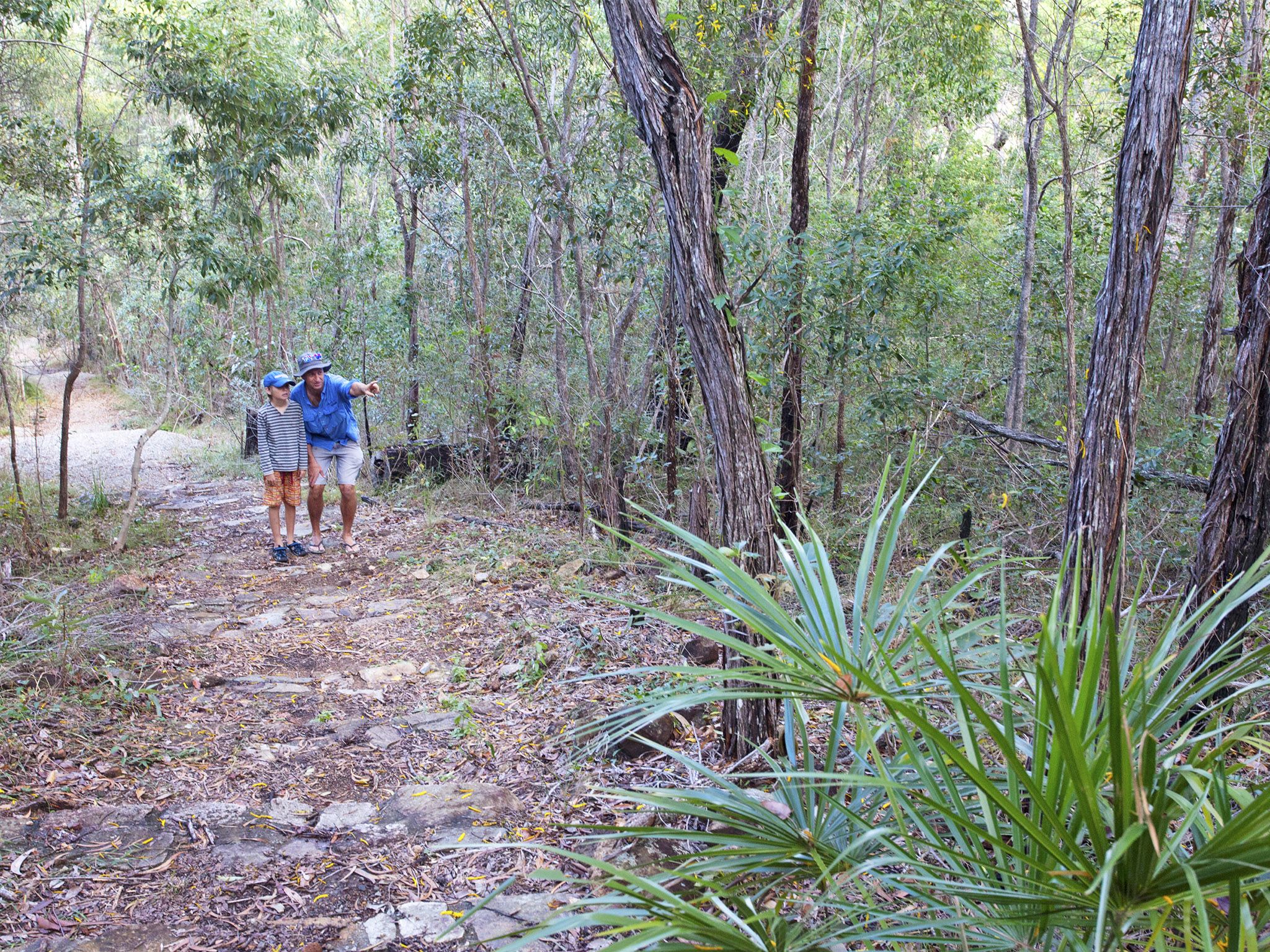
Mt Larcom Climb
91 Lynn Rd, Targinnie, Queensland
The prominent landmark provides a good ascent of two hours or so. The reward is a 360-degree view of the Gladstone area, rural lands and the harbour. On a clear day, you will see reef islands to the east and Rockhampton northwards. Mt Larcom is of volcanic origin, and your walk takes you through light eucalypt forest and grass trees, whilst on rough and loose ground. It is a challenging walk, and best climbed in the cooler months, with an early start to capture the best views. The walk and climb is steep in places and is not recommended for younger children. No toilet facilities. Bring plenty of water with you.
Return Length: 6.6km
Average Completion: 4h 30m
Elevation: 632m
Difficulty: Hard
Boyne Valley

Boyne BURNETT INLAND RAIL TRAIL
BOYNE VALLEY, Queensland
BBIRT is designed to attract active families, avid hikers, rail trail and adventure enthusiasts to experience the scenic landscapes and historic rail heritage of the Gladstone and North Burnett regions.
- The 26 km Dawes Range section offers offers stunning mountain views as it passes through six tunnels in towards the top, with an array of National Parks nearby
- The 32km Mt Debateable to Mundubbera section follows the Burnett River for most of the way, has great views of some beautiful heritage bridges, with opportunities for canoeing
- The 7km section from Mt Debateable to Reids Creek is open.
- The 6km Four Mile Scrub to Boynedale Bush Camp section is along the shores of Lake Awoonga.
- The corridor from Targoola to Gayndah is 270km long, so potentially could be Australia’s longest rail trail
- Camping available along the rail trail.
Gladstone Region Tours and Packs N Pedals are available for guided/ assisted adventures.
GLADstone

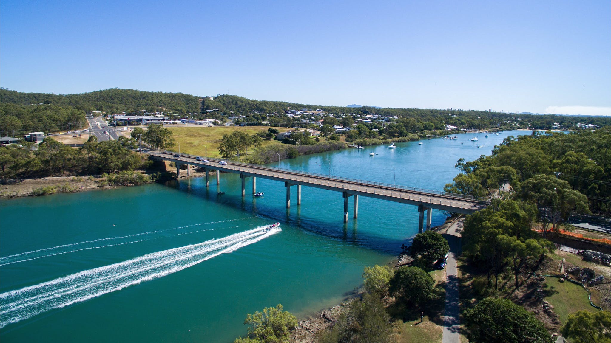
East Shores to Spinnaker Park
Flinders Parade, Gladstone Central, Queensland
A good early morning or afternoon trail exploring the Gladstone Harbour. The trail begins from the East Shores Carpark and takes you across the Bryan Jordan Drive Bridge to Palm Point. From here you’ll keep following the waters edge, up and alongside Alf O’Rourke Drive and then down into Spinnaker Park, where there’s a cafe to refresh yourself. The trail itself is paved and flat the whole way.
Return Length: 8.9km
Average Completion: 1h 50m
Elevation: 70m
Difficulty: Moderate
Dog Friendly: Welcomed on leash
Happy Valley, Fitness Trail
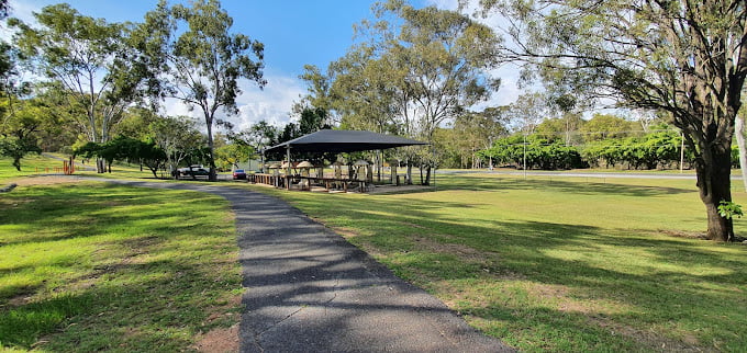
Glenlyon St, South Gladstone, Queensland
The park welcomes walkers, runners, and mountain bikers to come and sweat on their numerous outdoor exercise machines, or to just simply have a wander around. The route follows paved paths throughout the shady wooded domain and features a few steps to climb along the way. The trailhead is accessible from Glenylon Street, you will find a public parking area here.
Return Length: 1.6km
Average Completion: 27m
Elevation: 50m
Difficulty: Easy
Dog Friendly: Welcomed, may be off-leash in areas

BOYNE ISLAND & TANNUM SANDS
BOYNE ISLAND FORESHORE, VIA TURTLE WAY
BOYNE ISLAND, Queensland
This track winds along the shores of the Boyne River that runs between the twin towns of Boyne Island and Tannum Sands in central Queensland. The trail commences from Jacaranda Drive next to the Boyne Tannum Caravan Park and follows shared-use trails north along the river. Along the way, you’ll pass plenty of amenities such as parks and public toilets as well as a café and plenty of idyllic spots to pull up a picnic blanket and enjoy the views. This is a shared path and therefore is open to all kinds of transport, be careful walking and always use your bell when passing pedestrians on your bike.
Return Length: 13.2km
Average Completion: 2h 45m
Elevation: 118m
Difficulty: Moderate
Dog Friendly: Welcomed
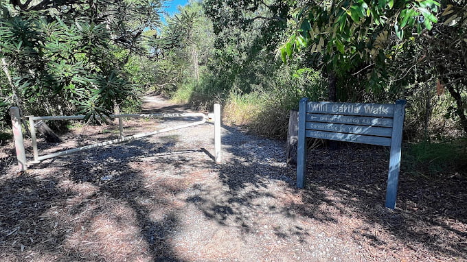
Wild Cattle Walk
Tannum Sands, Queensland
Drive to the end of Wild Cattle Creek Rd in Tannum Sands. At the end of the road there will be a large turn around and you will also find a boat ramp and the trail head to the right clearly marked. Beautiful scenery along the way. At the end of the trail there is an opening that allows you to look over mangroves and Wild Cattle Island. Perfect spot for sunrise or sunset.
Return Length: 4.6km
Elevation: 1m
Difficulty: Easy
Dog Friendly: Welcomed
AGNES WATER & TOWN OF 1770
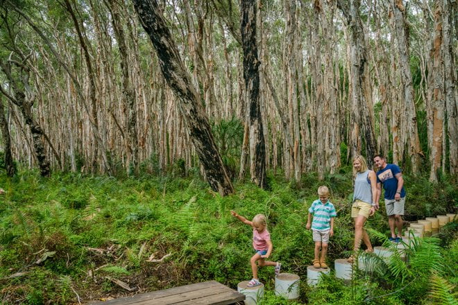
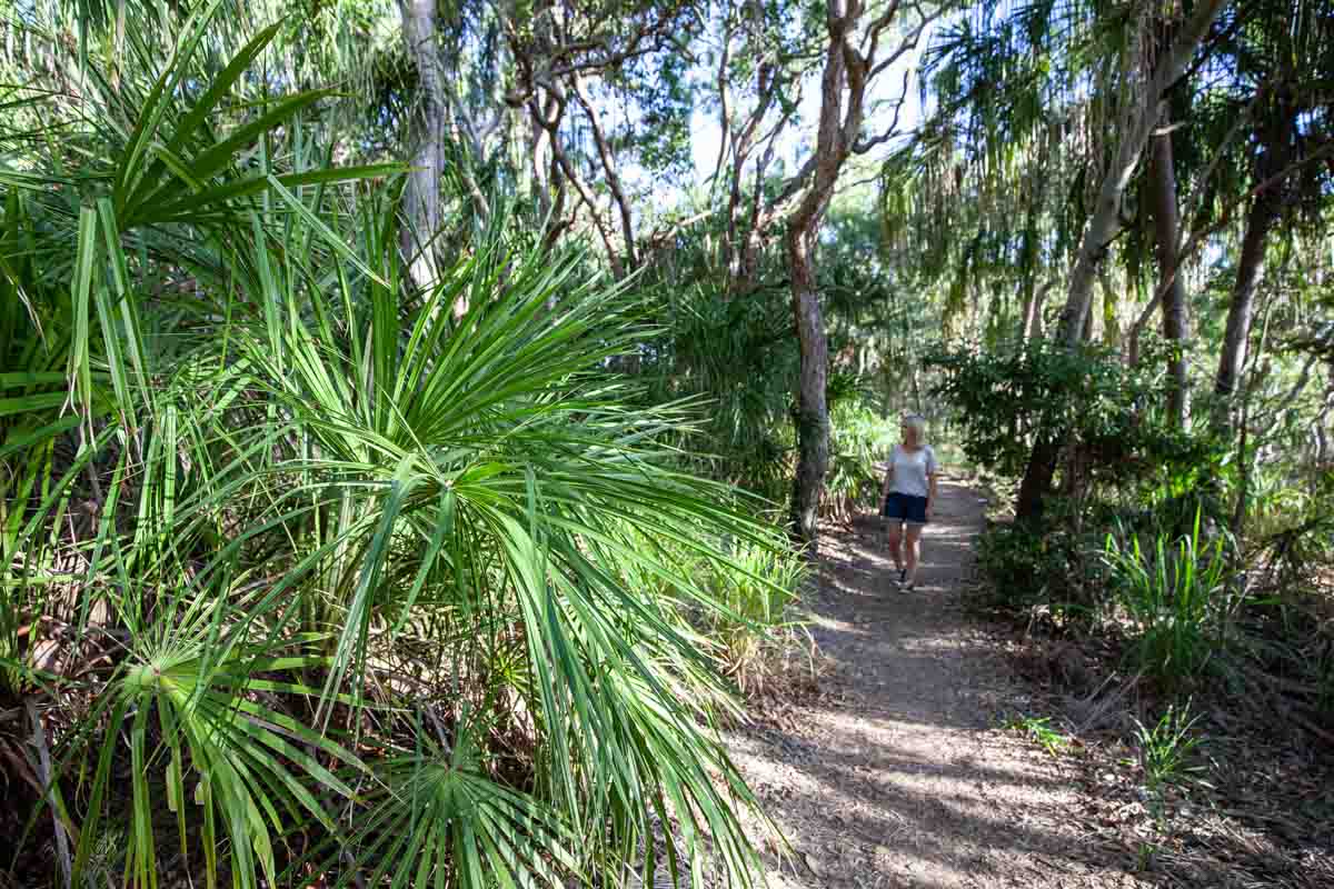
Paperbark Forest Walk
Agnes WATER, Queensland
*TemporARILY CLOSED
A trip to Agnes Water wouldn’t be complete without visiting this hidden gem. An enchanted forest hidden beneath the trees, you’ll feel like a little fairy as you step along the steppingstone path and boardwalk trail that sits above the water. You’ll dive deeper and deeper into the forest and become surrounded by hundreds of paperbark trees and the majestic greenery of the forest floor. Find yourself lost in the noise of the little tree frogs and an array of beautiful butterflies.v
Return Length: 400m
Difficulty: Easy
Dog Friendly: No
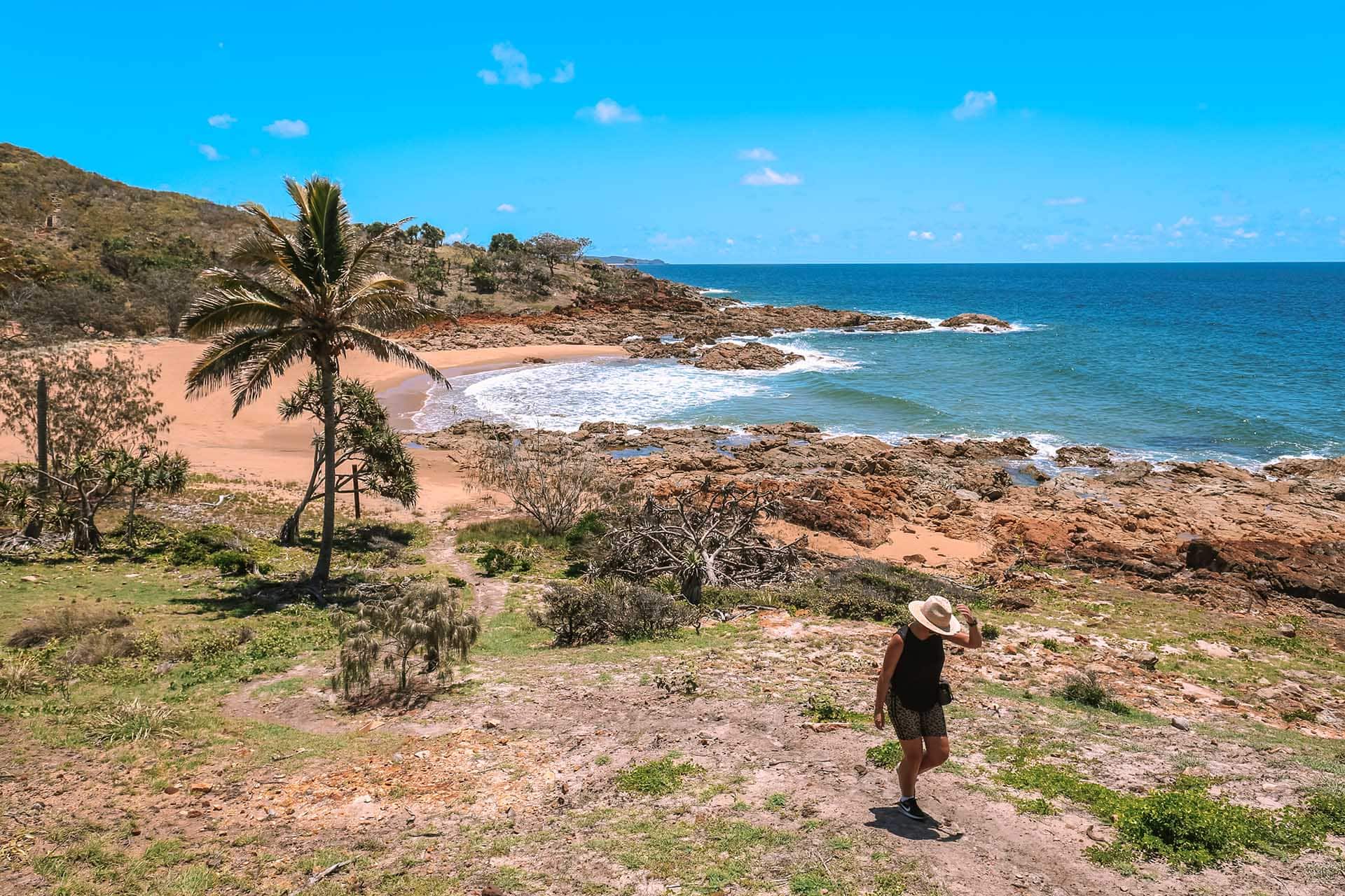
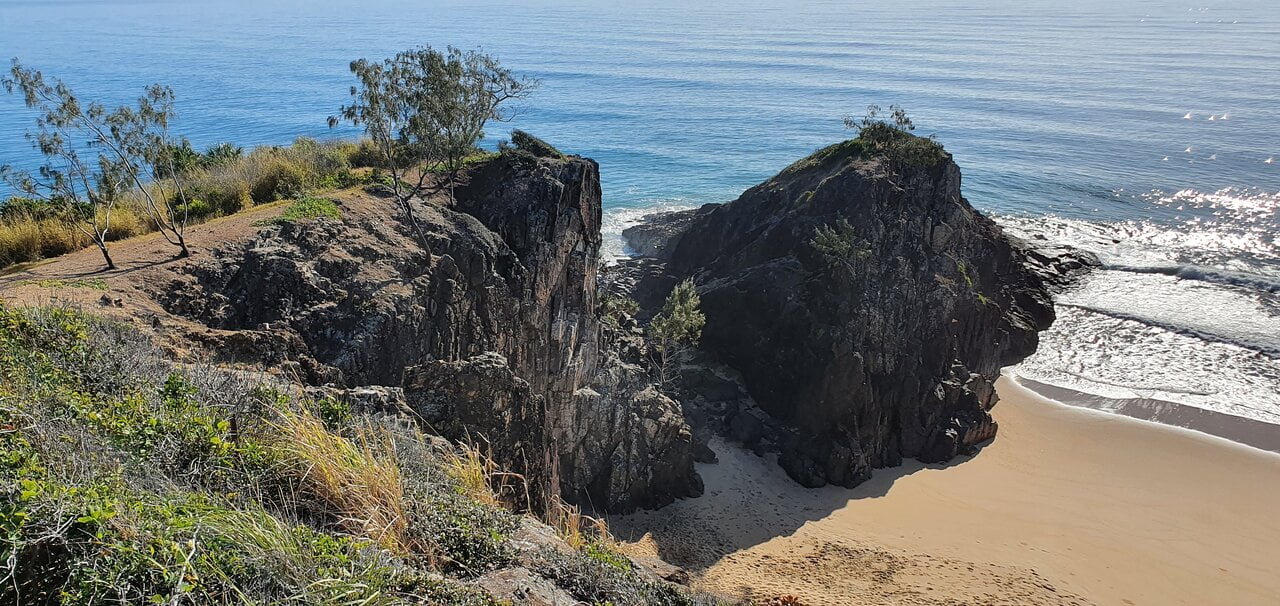
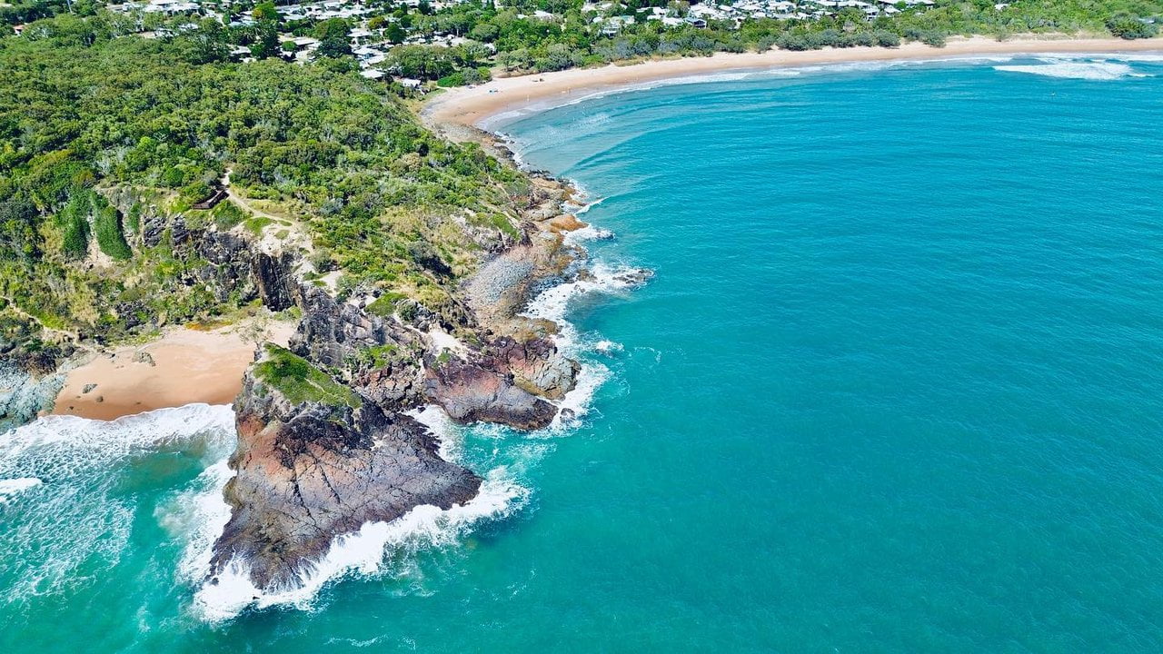
RED ROCK WALKING TRAIL
Agnes WATER, Queensland
A beautiful coastal walk. You’ll get a bit of everything on this trail from boardwalks, beach access, short uphills, and amazing views as you walk along the ocean path. This picturesque trail will give your legs a bit of a workout. Stop on the way for a refreshing dip in the ocean, or a picnic along the beach. You may even spot a kangaroo bathing in the sun or some turtle eggs hidden amongst the foreshore. To get here follow springs road for approximately 2.5 kilometres and enter the sandy track on the left, opposite the “Reedy Creek Reserve” sign. Follow the track for 800 meters and park near the trees.
Return Length: 5m
Average Completion: 3.5h
Difficulty: Intermediate
Dog Friendly: No
The BUTTERFLY WALKiNG TRAIL
Agnes WATER, Queensland
Discover the beauty of the Joseph Banks Conservation Park. A relatively easy trail however there are some steep steps that will lead to incredible log bridges crossing gullies and end with an incredible lookout of Round Hill Creek and Bustard Bay. Through Autumn and Winter, you’ll see the spectacular Blue Tiger Butterflies. These species of butterfly migrate to Agnes Water by the thousands and were even sighted on Captain Cook’s voyage.
Return Length: 2.4km
Average Completion: 1.5h
Difficulty: Moderate
Dog Friendly: No
DISCOVERY TRAIL
Agnes WATER, Queensland
For this trail park behind the Museum on Springs Road. Here you’ll find a large trail map in the carpark to direct you on your way. This trail will lead you to the spectacular Agnes Water Lookout on a wonderful bush track. View breathtaking views of Agnes Water Beach and Workman’s beach.
Return Length: 2km
Average Completion: 30m
Difficulty: Intermediate
Dog Friendly: Welcomed, on-leash
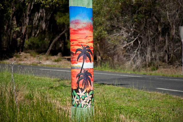
POLE ART TRAIL
Agnes WATER, Queensland
Make your way around Agnes Water and the Town of 1770 and view the spectacular series of individually artistically painted power poles by the Agnes Water Cultural Art Trail Group. An incredible initiative to bring colour and an artistic flair to the town. The theme is flora, fauna, and indigenous design.
Travel by vehicle to all artworks OR
Average Completion: 2h
Please visit our website to view an interactive map with all 58 pole locations – Agnes Water & Town of 1770 Pole Art Trail – The Gladstone Region
GANGOONGA NOOGA LOOKOUT TRAIL
EURIMBULA, Queensland
Leave the worries of the world behind and take a hike on the Ganoonga Noonga track. Located in Eurimbula National Park, 14km west of Agnes Water. To access this track you’ll need a 4WD. Once you’re on the trail you’ll pass through grassy woodlands grand gums and bloodwood trees. You’ll head down a steep trail that will lead to an incredible lookout boasting sensational views of the surrounding coastal lowlands from the Munro Range to the west and Bray Hills and Bustard Bay to the north. Don’t let the steep trail put you off, we can assure you it’s worth the effort.
Return Length: 720m
Average Completion: 30m
Elevation: 70m
Difficulty: Intermediate
Dog Friendly: No
Scooter & Bike Trail: Agnes water Icons
Agnes Water & Town of 1770
With the introduction of e-scooters to Agnes Water, take to the footpaths and scoot your way around town, jumping from icon to icon, trying local delicacies, scoping out the lookouts and frolicking by the beaches.
Start your journey at the 1770 Headland and follow the continuous footpath to the centre of Agnes Water, by-passing:
- Round Hill Creek Walking Trail
- Town of 1770 Beach and SUP Board
- Katrina’s Bar 1770
- 1770 Discovery Rotary Markets
- Coral Sea Seafood and Takeaway
- Codie’s Place
- Holiday’s Cafe
- Agnes Water Main Beach
- 1770 Gelato Co.
Return Length: 9.5km
Difficulty: Moderate